Projects
Geography 176a
- Current Fall 2021 class using ArcGIS Pro and other related GIS applications.
A collection of labs from Geography 13, an R Studio computer programming based class for geospatial data analysis.
Lab 1
- In this assignment I used Github to build websites and repositories
- I learned how to use R and how to knit into a html
- I know how to push files from R to Github
Lab 2
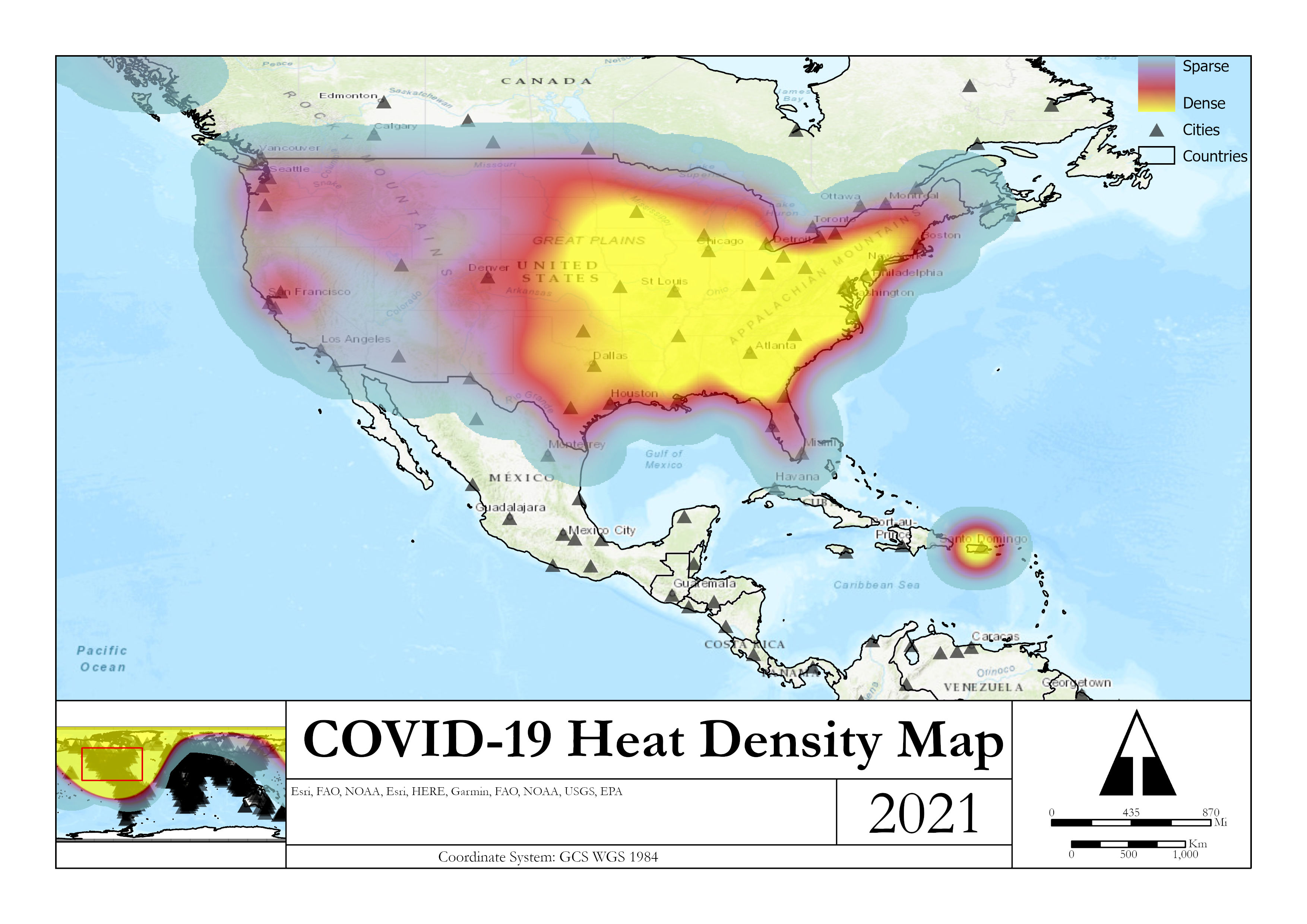
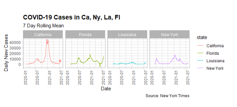
- For this assignment, I used packages of tidyverse
- Each package was used to analyze specific COVID-19 data
- The lab was intended to practice data wrangling and visualization skills
Lab 3
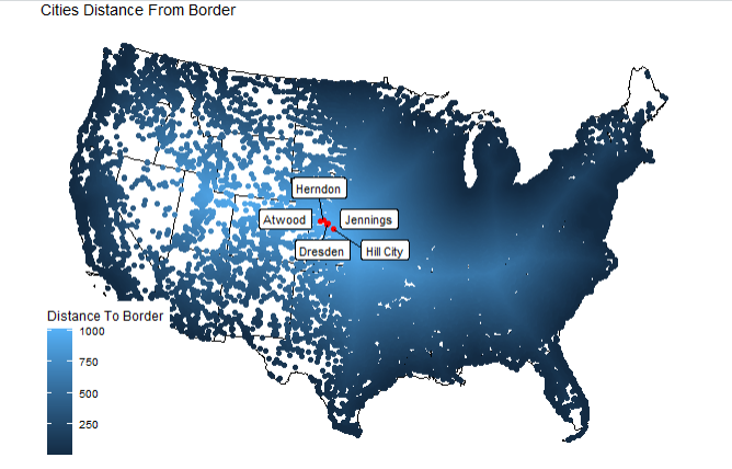
- This lab was my favorite!
- I used spatial features (sf) and objects to create distances and projects
- I especially enjoyed working with ggplot to create maps, and using fun colors for filtering in data
Lab 4
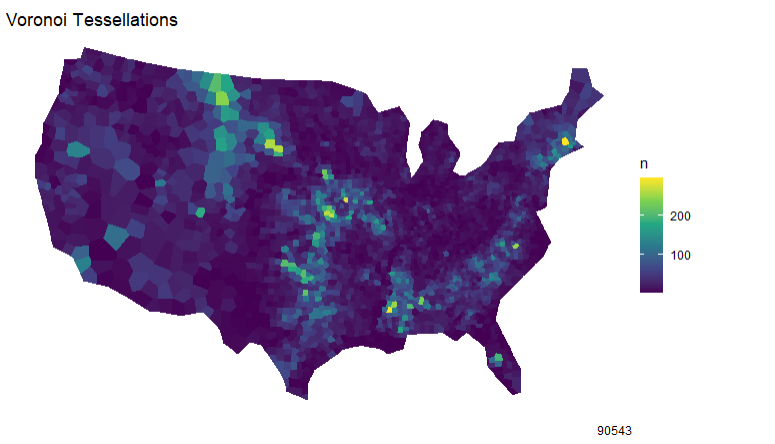
- For me, this lab was the most challenging, yet most pleasing
- This lab required reading in Nation Dams to answer questions of geometry simplification, centroid generation, and tessellations
- It was the most pleasing because of the voroni, triangulation, square and hexagonal graphs of the United States
Geography 183
- For another class, I had to publish all of my work to a website. It is a collection of a series of labs, ranging from QGIS to Google Earth labs.